Friends of Barnstable Harbor invites you to join us in safeguarding our beautiful, bountiful and time-honored Barnstable Harbor.
Scientific-based data is one of the best tools we can use to provide this protection for generations to come.
The Benthic Habitat Mapping Project (BHMP) & Finfish-Shellfish Study (FF-SFS) will give us a physical and biological “snapshot in time”. This snapshot will provide invaluable data for the protection, preservation, and planning for the evolution of the harbor. The Center for Coastal Studies will perform both projects. The BHMP, will be overseen by coastal geologist Mark Borrelli, and the FF-SFS will be executed by marine fisheries researcher Owen Nichols. Our BHMP will join BHMP projects already completed by the Center for Coastal Studies for Provincetown, Truro, and Wellfleet Harbors, and will contribute essential information for the entire Cape Cod Bay ecosystem and coastal food chain.
Benthic Habitat Mapping
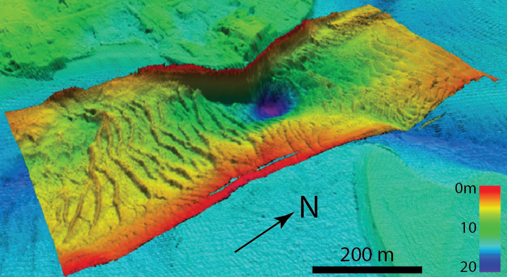
Benthic Habitat Mapping combines state of the art side-scan sonar imagery and GPS coordinates with benthic grabs (2-gallon samples of sediment and macro invertebrate species), to produce a detailed snapshot of the harbor’s sea floor. The results will provide the blueprint for informing harbor management decisions including: dredging, sediment management and mooring field and aquaculture expansion. It will also supply essential data for use as a baseline reference in the event of a major storm or pollution event.
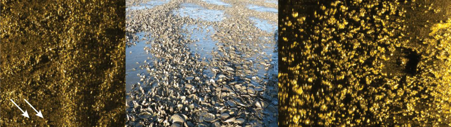
Friends of Barnstable Harbor’s BHMP will map the entire harbor insuring that we have a comprehensive understanding of the complete harbor ecosystem. Data will include detailed imagery and location of eelgrass beds, natural shellfish beds, and marine debris, as well as sediment types and macro-invertebrate counts.
The last time Barnstable Harbor was mapped was in the 1930’s utilizing a lead-line and a benchmark survey from Mussel Point. Our BHMP will conform to current Coastal and Marine Ecological Classification Standards (CMECS). We believe that our BHMP will attract more scientists to conduct studies in our harbor, thus begetting further research and data.
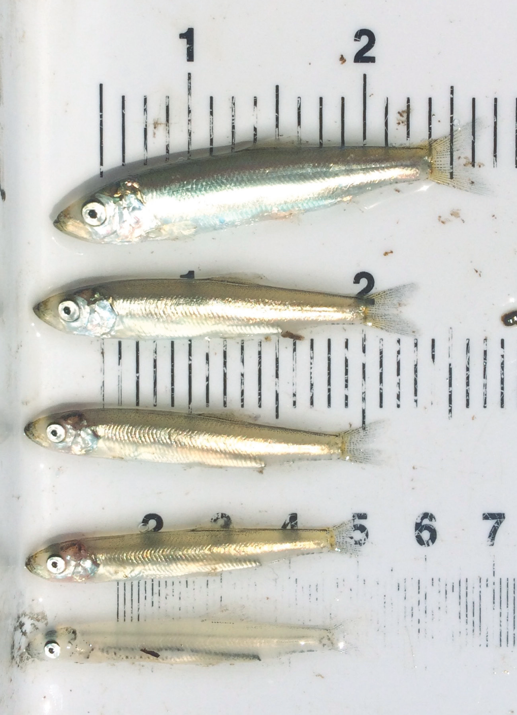
The Finfish-Shellfish Study
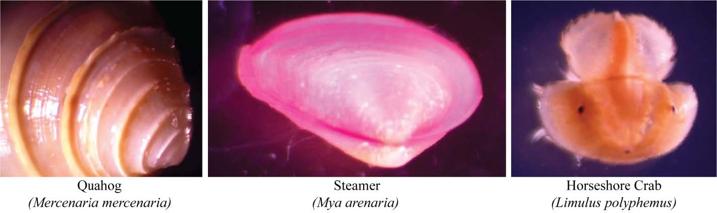
Owen Nichols’ team will collect an inventory of finfish and shellfish from Barnstable Harbor, with a focus on commercially and recreationally important species. Intertidal and subtidal fish and invertebrate sampling will be conducted for a yearlong period beginning in the spring of 2019. Subtidal sampling stations will be chosen as a random subset of sites identified by the BHMP. Sampling methods will include beach seines, trawls, dredges, ventless lobster traps, passive collectors, and gillnets.
Finally, upon completion of the entire project, we will have an image of our harbor’s health, as well as be able to identify specific areas of concern. The utilization of drone technology and/or re-sampling will enable us to document and understand trends in our harbor system.
The Center for Coastal Studies projects the cost for the total project to be $250,000. Data collection for mapping and benthic samples were completed in September 2018. Sorting, counting and documentation of benthic samples is ongoing. The FF-SFS will begin this spring. We anticipate a final report will be delivered by fall 2020.
Your tax-deductible contribution to the Benthic Habitat Mapping Project/ Finfish-Shellfish Study will help to preserve and protect Barnstable Harbor. The resulting snapshot will be instrumental for guaranteeing that future generations will experience the same magnificent Barnstable Harbor that we enjoy, and that has been an economic and recreational centerpiece of Cape Cod’s north side for hundreds of years.
Friends of Barnstable Harbor is a 501c3 public charity non-profit corporation
Below are links to Pleasant Bay Reports from projects conducted by the Center for Coastal Studies over the past several years:
Friends of Pleasant Bay Benthic Report -Summary
Center for Coastal Studies Pleasant Bay Report Final 2018 Full Technical Report