Friends of Barnstable Harbor’s habitat mapping will help us in safeguarding our beautiful, bountiful and time-honored Barnstable Harbor
Press coverage of this project:
Here is the Final Report for the Benthic Habitat Mapping Project:
Scientific-based data is one of the best tools we can use to provide this protection for generations to come
Seafloor & Habitat Mapping
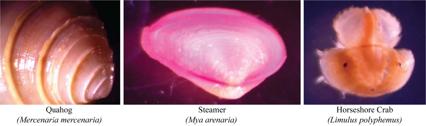
Seafloor & Habitat Mapping combines state of the art side-scan sonar imagery and GPS coordinates with benthic/seafloor grab sampling. These 2-gallon samples of sediment and macro invertebrate species are identified, sorted, and counted. This combination of data produces a detailed snapshot of the harbor’s sea floor. The results will provide the blueprint for informing harbor management decisions. Such decisions include: dredging, sediment management and mooring field and aquaculture expansion. It will also supply essential data for use as a baseline reference in the event of a major storm or pollution event.
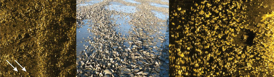
Friends of Barnstable Harbor Benthic Habitat Mapping project gives us a comprehensive understanding of the harbor’s floor (benthos). Data will include detailed imagery of marsh erosion, some invasive species, and marine debris, as well as sediment types and macro-invertebrate counts.
The last time Barnstable Harbor was mapped was in the 1930’s utilizing a lead-line and a benchmark survey from Mussel Point. Our Habitat Mapping will conform to current Coastal and Marine Ecological Classification Standards (CMECS). We believe that our project will attract more scientists to conduct studies in our harbor, thus begetting further research and data.
These two Interim Reports show some information not included in the Final Report and are both worth a read:
2020 Interim Report:
2019 Interim Report